A little help please
Posted by viking75
| Registered: 5 years ago |
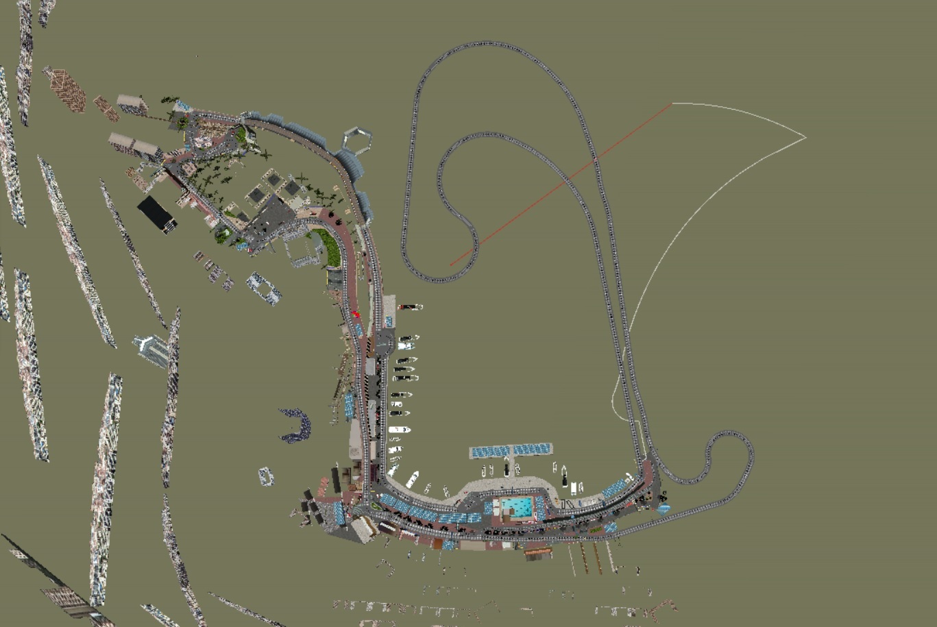
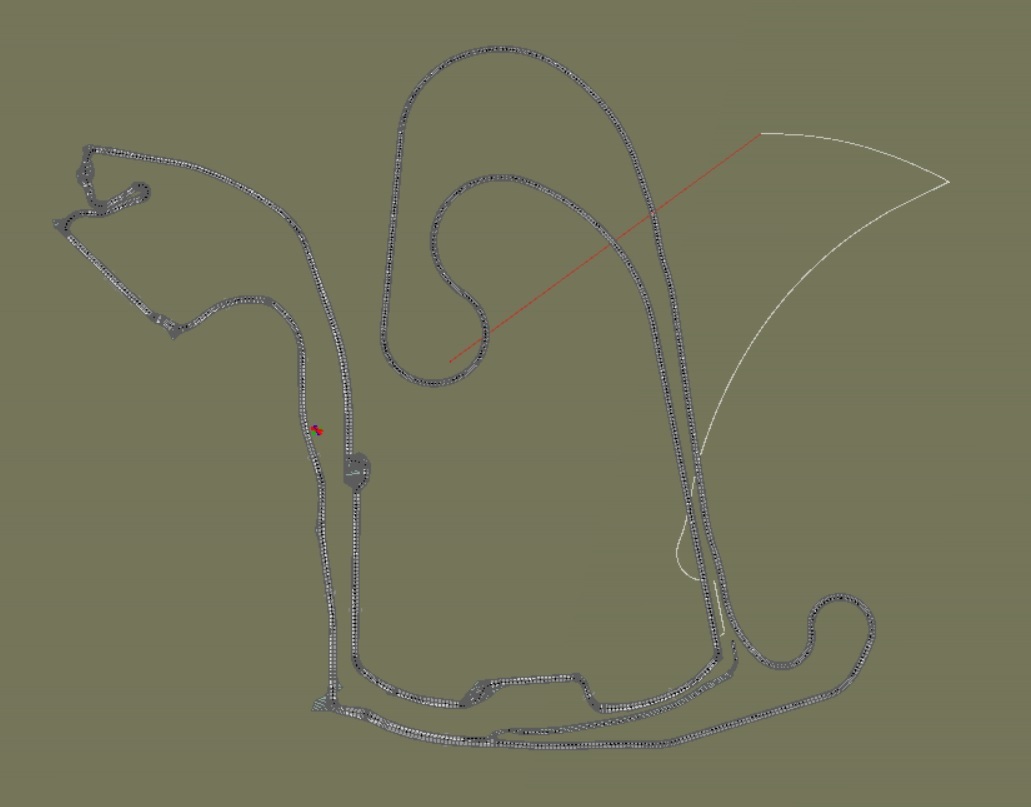
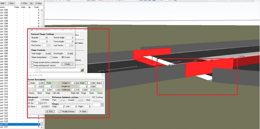
I began a few weeks ago to learn by myself to create a dat file for not to take the ones of some of you. I want to do Côte d'Azur, like in project car 2 that begins in Monaco, as you see in my shots, and goes to Nice and italian border. I know that in a second time I will must modify the cc line, but first I have a problem I can't solve since the beginning of my work. As you see on the third screnshot the sector doesn't follow the finish line. I try to understand which value I must use with the tools at the left to fix it, it's a question of exact elevation and I can't do nothing. Please, is someone to tell me what I have to do exactly ? Thank you so much.


| Registered: 11 years ago |
| Registered: 5 years ago |
")
| Registered: 16 years ago |
| Registered: 5 years ago |
Thank you jimbob, I'm interested to know how to do it and I'll send you the file. I thought of something else last night, maybe it would be better if I did the layout on the other side to already have the junction with the pits and the finish line, because it's still too difficult for me to make the junctions, which does not prevent that I am interested in your help about the dat on the screenshot above. Also, I don't forget that I will have to do the cc line afterwards. Thanks again ! (Google Translate)
[www.mediafire.com]
[www.mediafire.com]
| Registered: 5 years ago |
Hello again
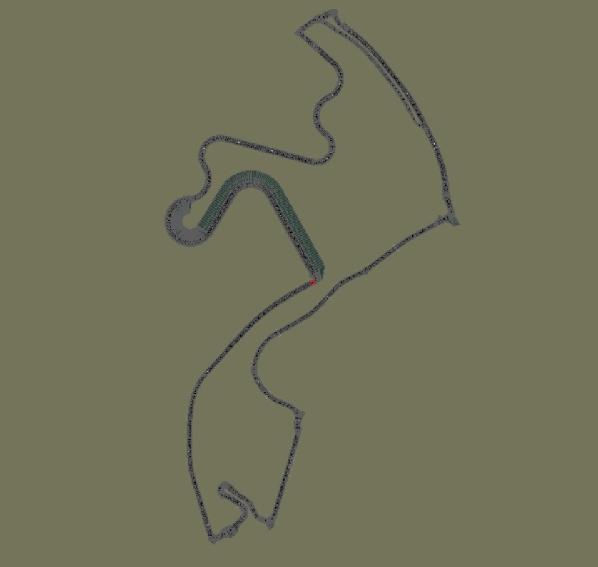
My purpose is to create a large addition to Monaco all around the sea but to do a new test I did just a little layout for now. For the first time all was ok with the onboard camera, but unfortunately the dat crashes in the game. Is someone can tell me why ? Is it because I did not do yet the cc line ? The add begins at the chicane after the tunnel and finishes à La Rascasse.
My purpose is to create a large addition to Monaco all around the sea but to do a new test I did just a little layout for now. For the first time all was ok with the onboard camera, but unfortunately the dat crashes in the game. Is someone can tell me why ? Is it because I did not do yet the cc line ? The add begins at the chicane after the tunnel and finishes à La Rascasse.

| Registered: 18 years ago |
If the old cc-line is still on your .dat, then you must delete the sections that conflict with the new part of the track.
If you have deleted the cc-line already, then it's something else that's causing your track to crash. Check the Track Flags List window (Tools menu) for possible errors.

My unfinished tracks: [www.grandprixgames.org]
Send bug reports and track editing questions to f1virtualblog@gmail.com
If you have deleted the cc-line already, then it's something else that's causing your track to crash. Check the Track Flags List window (Tools menu) for possible errors.
My unfinished tracks: [www.grandprixgames.org]
Send bug reports and track editing questions to f1virtualblog@gmail.com
| Registered: 5 years ago |
| Registered: 5 years ago |
Now it works, thanks again. It's strange cause the track flags list shows me many errors about missing kerbs description but it works ") Of course, for this moment it's difficult to drive well cause I must do the cc line and the tarmac (and cameras too). It will be other new steps for me and I think the most difficult comes now. Thanks again.
Of course, for this moment it's difficult to drive well cause I must do the cc line and the tarmac (and cameras too). It will be other new steps for me and I think the most difficult comes now. Thanks again.
Of course, for this moment it's difficult to drive well cause I must do the cc line and the tarmac (and cameras too). It will be other new steps for me and I think the most difficult comes now. Thanks again.Sorry, only registered users may post in this forum.
GP3 CarshapesGP3 CART & other CarsGP3 CART & other TracksGP3 CockpitsGP3 Editors / UtilitiesGP3 F1 CarsGP3 F1 TracksGP3 Fictional CarsGP3 Fictional TracksGP3 Graphics (Software Mode)GP3 HelmetsGP3 MiscGP3 Misc. GraphicsGP3 PatchesGP3 PitcrewsGP3 Season PackagesGP3 SetupsGP3 SoundsGP3 TeamartGP3 Trackgraphics
Maintainer: mortal, stephan | Design: stephan, Lo2k | Moderatoren: mortal, TomMK, Noog, stephan | Downloads: Lo2k | Supported by: Atlassian Experts Berlin | Forum Rules | Policy